Advanced radar applications in terrestrial geosciences - from GPR to ground-based, airborne and spaceborne SARs
Dr Christian Koyama | School of Science and Engineering | Tokyo Denki University
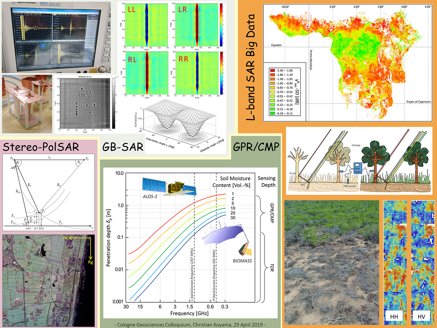
Abstract: Since its first demonstration in Cologne 115 years ago, the radar principle has indisputably matured to one of the great engineering achievements in the 20th century not only for the military but also for civil applications like air traffic control, ship safety and weather observation. In the field of terrestrial geosciences, radar remote sensing has become the tool of choice for a wide range of applications including estimation of biomass and soil moisture, ground-water exploration, land surface deformation mapping, and tropical forest monitoring. Following NASA’s shuttle-based radar missions in the 1980ies, the era of synthetic aperture radar (SAR) earth observation (EO) satellites began with the launch of ESA’s ERS-1 operating at C-band (4-8 GHz). The orbital L-band (1-2 GHz) SAR history started one year later with Japan’s launch of JERS-1. After the characteristic data scarcity in the first two decades due to the few platforms in orbit, the number of radar EO satellites has been increasing significantly. Simultaneously, the use of ground-based (GB) SARs also has become more and more popular. The better data availability is expected to further boost the potential of radar applications in geosciences. Here we will discuss a variety of such radar techniques spanning from advanced ground penetrating radar (GPR) for soil moisture estimation at various depths to polarimetric ultra-wideband (UWB) near-range imaging and advanced stereo-PolSAR for disaster management. In addition, we will address at a high level the latest achievements in tropical forest observation and deforestation detection using big data timeseries.