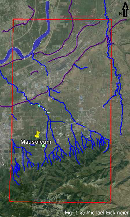
During the three months “GSGS-Start-up honours Grants” I conducted important preparatory work for a possible later proposal of a dissertation. At first the investigation area around the mausoleum of Qin Shihuangdis (Terracotta-Army, Xi´an, China) was precisely defined; promising sites and geomorphological characteristics of that region were identified. Especially the northern-southern course of the Qin Boulevard and two (?) dams south of the mausoleum, which presumably divert the water flow and protected the site, are of interest. A nearby fishponds, which might already existed during the Qin Dynasty, could enclose some archives, which were drilled in a field campaign and will be further investigated (cf. Fig. 1, light blue areas). Other stratigraphy are promised by the many loess profiles of the surrounding. Recent satellite data was very important for the reconstruction of the landscape.
Through visual remote sensing, the course of potential water flows and streams (blue lines), the location of ponds (light blue areas) and terraces of the Wei River (purple lines) could be mapped (cf. Fig. 1). Secondly, high resolution stereo images (Pleiaden) for 105 km2 (14*7.6 km) were selected and ordered (financed by the own resources of AG Prof. Bubenzer). The red rectangle in fig. 1 shows the location of those satellite images. Using ENVI DEM-Extraction, a highly resolute, digital elevation model of the region was generated, in which the mausoleum is also clearly visible (cf. Fig. 2).
M.Sc. Michael Eickmeier
Preparation of PhD application
Institute of Geography